
Seafloor Mapping
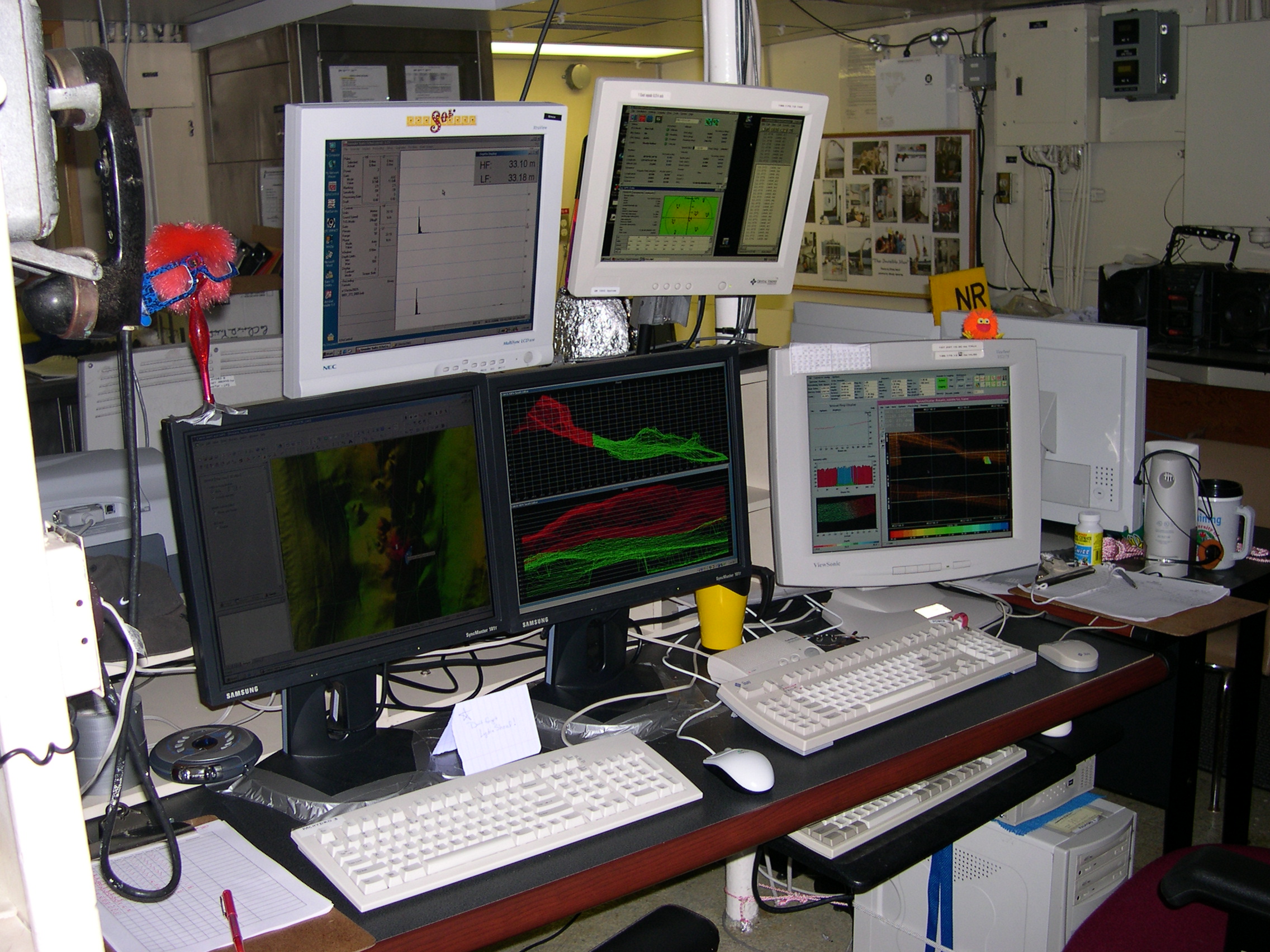
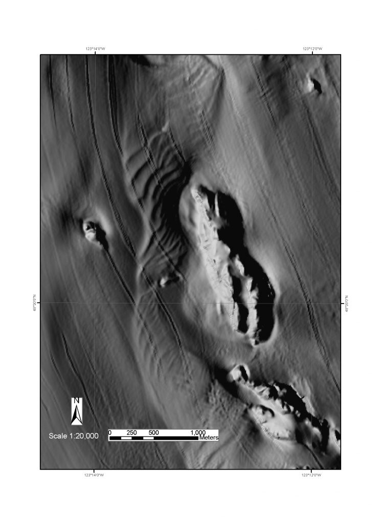 The Habitat Center utilizes multibeam bathymetric data (bathymetry xyz and backscatter data) to construct thematic maps including bathymetric artificial sun-shaded relief, geologic, geomorphic, geologic structure and hazards, habitat, contour, slope inclination, roughness derivative and other specialty maps. Arrays of soundings perpendicular to the ship’s track are emitted from a sonar system, make contact with the seafloor and are projected back to the sounder and recorded, providing 100% coverage. Frequency and resolution varies among sonar systems. The higher the frequency, the higher the data resolution at a certain water depth.
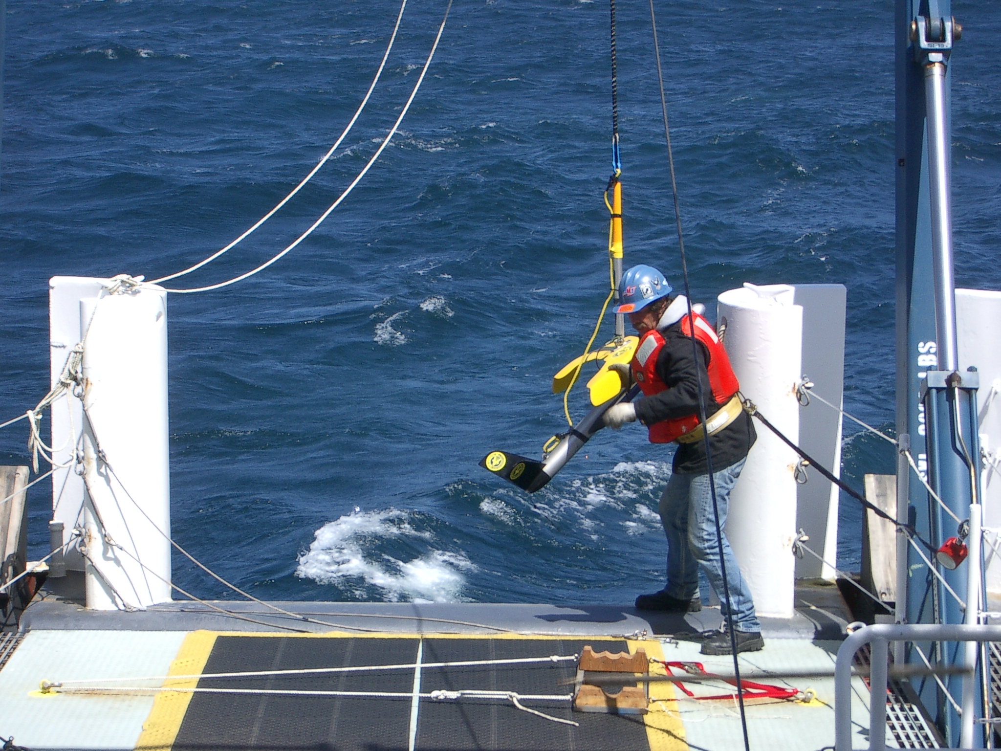
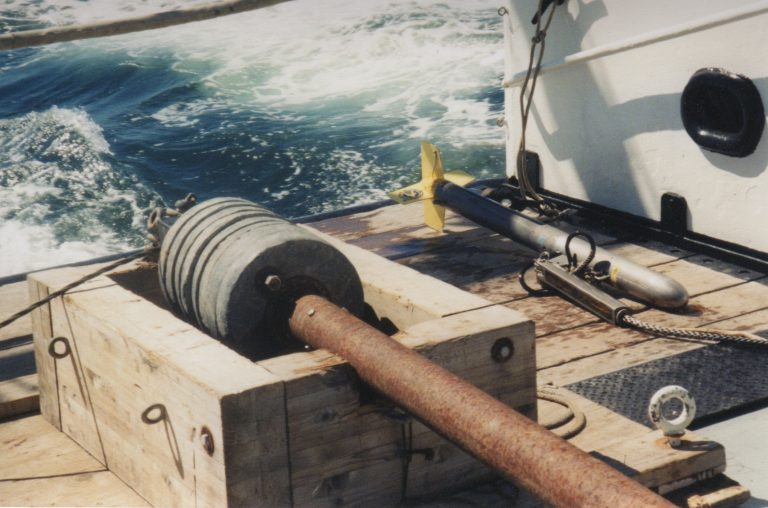
Several Multibeam Echosounders (MBES), including Reson,® and singlebeam bathymetric systems have been used to collect seafloor data for Center for Habitat Studies clients across the globe. Clients have used the MBES data for many different purposes including fisheries management, geohazards assessment and bedform dynamics. The MBES data provide clients with critical information about the depth and size of geologic, biologic and anthropogenic features. Depending on the sonar system being used, backscatter data are collected with the MBES data and provide texture information of the seafloor such as sand or gravel. Side-scan sonar (Sonar = sound navigation and ranging) systems are also used (including 100 kHz Klein® and EdgeTech®) to detect objects on the seafloor and collect textural information. Similar to multibeam and singlebeam sonars, a sidescan towfish transmits sound energy and records the strength of the return signal (echo) that has made contact with the seafloor or other objects. Objects projecting from the sea bottom create a strong return and, thus, show as a light area on the data. Areas of the seafloor with little or no return show as dark (or vice versa depending on operator settings). Most sonar systems do not collect depth information.
Aerial and Topographic Surveying
Scientists at the Center for Habitat Studies (CHS) utilize a Terrestrial Laser Scanner (TLS), which is useful for collecting information regarding surface topography. General topographic surveys are conducted and used to establish a baseline elevation framework in a specific area of interest. Each survey includes high resolution photographs and point clouds allowing for 3‐D image draping over DEM surfaces. Uses of a TLS include short (24 hr.) and long‐term (seasonal) change detection of tidal wetland environments as well as high-resolution surveys and quantification of beach sediment dynamics. Findings include identification of specific sites of fine‐scale erosion and/or deposition and correlation with hydrologic variability. The data are displayed in the form of before/after 3‐D images of geomorphologic change.
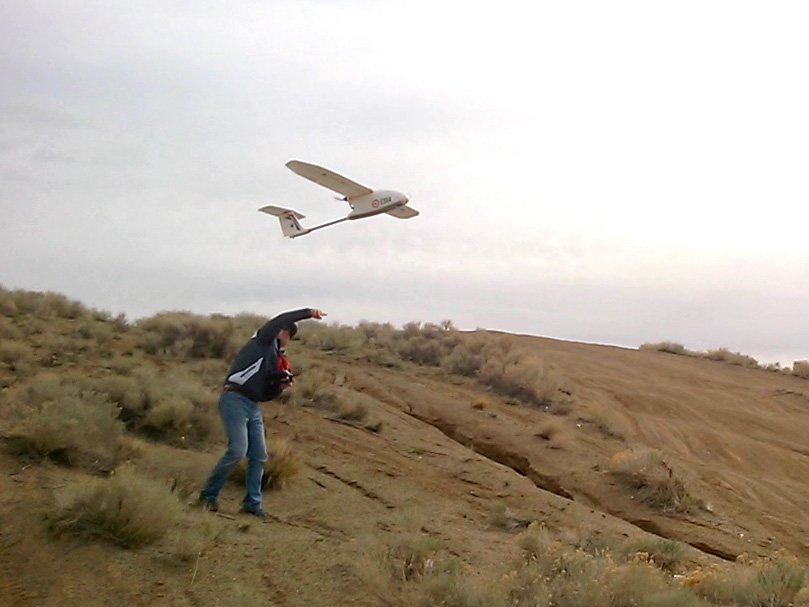
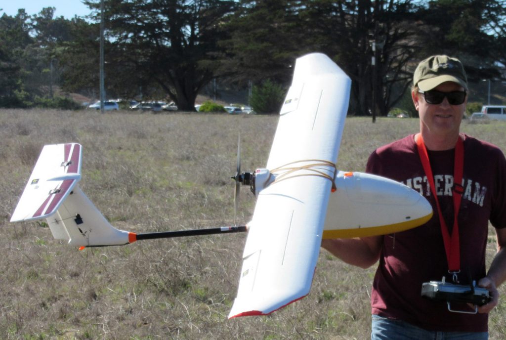
The CHS uses Unmanned Aerial Vehicles (UAV) for the purpose of surveying terrestrial and marine/freshwater areas. The UAV flies in the air without a human operator and uses aerodynamic forces to provide lift by a pilot on the ground. A UAV allows scientists to track and monitor biotic and abiotic elements without disturbance to the natural environment. Additionally, a UAV can collect orthoimages and elevation data of coastal drainage areas.
 Fine
Image Size: 2048 x 1536
Color
ConverterLens: None
Focal Length: 13.4mm
Exposure Mode: Manual
Metering Mode: Multi-Pattern
1/30 sec - f/3.6
Exposure Comp.: 0 EV
Sensitivity: ISO 100
White Balance: Auto
AF Mode: AF-C
Tone Comp: Auto
Flash Sync Mode: Front Curtain
Electric Zoom Ratio: 1.00
Saturation comp: +1
Sharpening: Auto
Noise Reduction: OFF
[#End of Shooting Data Section]")